
[Editor’s Note: Today’s post welcomes Lieutenant General Jim P. Isenhower and Mr. Jason Feser, for a podcast discussion on geospatial intelligence and its implications. In this episode of The Convergence podcast, they explore the critical role of geospatial intelligence, the challenge of battlefield transparency in large-scale combat operations (LSCO), and how emerging technologies are reshaping tactical maneuver. — Enjoy!]
[If the podcast dashboard is not rendering correctly for you, please click here to listen to the podcast.]
Lieutenant General Jim P. Isenhower was commissioned in 1992 from the United States Military Academy at West Point, New York. He served in the 1st Armored Division, 1st Cavalry Division, 25th Infantry Division, 101st Airborne Division (Air Assault), 2nd Stryker Cavalry Regiment, U.S. Army Pacific, 1st U.S. Army, and at the Pentagon on the Joint Staff and the Army Staff. Lieutenant General Isenhower has commanded echelons through the Division level.
He also served as an assistant professor in the Department of History at the United States Military Academy, and as the executive officer to the Commanding General, U.S. Army Pacific and to the Director of the Army Staff. He most recently served as the assistant Deputy Chief of Staff, G357 at Headquarters, Department of the Army. He currently serves as the Commanding General of the Combined Arms Command and Fort Leavenworth, Kansas. LTG Isenhower has participated in operational deployments in Panama, Bosnia-Herzegovina, and throughout the IndoPacific. He served three combat tours in Iraq in Mosul, Baghdad, and the Diyala Province.
LTG Isenhower’s military education includes the Infantry Officer Basic Course, the Armor Officer Advanced Course, the Command and General Staff College, and the National War College. He holds a BS from the U.S. Military Academy, an MS from the National War College and an MA and PhD from Duke University.
CW4 Jason Feser (ret.) currently serves as the Branch Chief for the Data Generation and Production Branch, Warfighter Support Division within the U.S. Army Geospatial Center (AGC). In this role, Mr. Feser oversees a staff of fifteen civilians and contractors that enable geospatial data collection, processing, and dissemination to the U.S. Army’s generating and operating force. Mr. Feser is responsible for three critical product lines, at various scales, to meet the Army’s requirements for digital mapping and geospatial analysis for customers at all echelons.
Prior to coming to the Army Geospatial Center as a civilian, Mr. Feser spent 27 years in the Army as a Geospatial Engineer, and Geospatial Engineering Technician, before retiring in 2019. Mr. Feser’s career included deployments to Bosnia, Kosovo, Jordan and multiple deployments in Iraq. Throughout his career, Mr. Feser has been devoted to bringing advanced geospatial techniques, resources and tools to the lowest tactical level. He has been a part of several Army initiatives focused on transformation and innovation, to include Stryker Brigade Combat Team transformation, and fielding the first Buckeye High Resolution Mapping System in Mosul, Iraq.
Mr. Feser is currently engaged in transforming AGC’s Engineer Route Study, Regional Terrain Planner, and Urban Tactical Planner Product lines. This transformation includes updating production pipelines, managing federated finishing amongst Army Geospatial Engineer Teams, and leveraging exquisite capabilities and tools found within the broader U.S. Army Corps of Engineer Research Development Centers.
The following bullet points highlight key insights from our conversation:
- The convergence of proliferated commercial and military remote sensing, and pervasive network connectivity has created an unprecedented level of battlefield transparency. Sensing capabilities across multiple domains now empower forces to detect and track surface activity down to an eight-digit grid coordinate in near-real time. This evolution has turned modern large-scale combat operations into an unforgiving competition between “the hiders and the finders,” establishing a battlefield dynamic where any asset that can be seen will be targeted and destroyed.
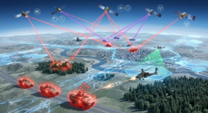
- Embedded geospatial engineers within Army formations provide the vital link that translates raw imagery and sensor feeds into structured, actionable Geospatial Intelligence (GEOINT). By synthesizing foundational raster layers, vector terrain features, and web-based services, analysts build the comprehensive operational picture required for effective command and control. Geospatial analysis must penetrate multiple layers of physical, environmental, cultural, and infrastructural data so commanders understand the full multi-domain complexity of the battlespace.

- Real-world tactical maneuver experiences, such as operating within canal-dense agricultural networks like Iraq’s “bread basket,” illustrate the lifesaving value of granular micro-terrain intelligence. In environments where off-road mobility is constrained by soil composition, irrigation ditches, or concealed natural obstacles, high-resolution route and terrain planning directly mitigates operational risk. This tactical reality proves that exquisite strategic-level terrain data is only valuable if it can be rapidly tailored, shared, and exploited by tactical Warfighters at the bleeding edge before they cross the line of departure.
- The sheer volume of geospatial and sensor data flowing into operational command posts routinely exceeds human analytic capacity, necessitating the immediate integration of artificial intelligence with this data. Automated feature extraction, computer vision, and change-detection systems can rapidly identify critical terrain modifications and enemy positions from massive imagery streams. Harnessing these automated processing pipelines shifts military geospatial analysts away from manual digitizing, allowing them to focus on predictive reasoning and drastically compressing the sensor-to-shooter cycle.

- Realistic operational preparation and mission rehearsal depend heavily on high-fidelity, authoritative geospatial data feeding advanced military simulations. The Army’s Synthetic Training Environment (STE) and Next-Generation Constructive (NGC) simulations rely on this data to accurately replicate the complex friction, geometry, and obstacles of real-world terrain. By embedding accurate terrain data into these advanced training architectures, the Army ensures Warfighters can experience “safe failure” and hone collective decision-making against realistic adversary capabilities before entering actual combat.
Key Terms and Definitions:
- Raster Data: This is a type of data that consists of a matrix of cells (or pixels) organized into rows and columns (or a grid) where each cell contains a value representing information, such as temperature.
- Vector Data: This type of data is represented by points, lines, and polygons and is used to represent geographic features in the real world.
- Geospatial Services: These are web-based services that provide access to geospatial data and functionality, such as online maps and routing services.
- Geospatial Intelligence (GEOINT): This is intelligence about the human activity on earth derived from the exploitation and analysis of imagery and geospatial information.
 If you enjoyed this post, check out the T2COM G-2’s Operational Environment Enterprise web page, brimming with authoritative information on the Operational Environment and how our adversaries fight.
Disclaimer: The views expressed in this blog post do not necessarily reflect those of the U.S. Department of War, Department of the Army, or the U.S. Army Transformation and Training Command (T2COM).